


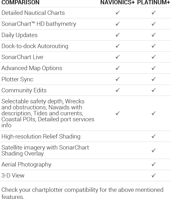
Relief shading
Easily Interpret Bottom Structure
Relief shading delivers highly detailed shading that combines colour and shadow to provide an easy-to-interpret, clearer view of bottom structure than contour lines alone.

Identify Topography Quickly
For coastal and inland boat owners who need to know as much as possible about sea and lakes beds, relief shading offers a better understanding of bottom detail for improved fishing and diving.
In some cases, high-resolution data is mixed with low-resolution data to produce a more complete image. The most convenient way to preview relief shading in your area of interest is on the Navionics Boating app.

How to Get Relief Shading
Included as a downloadable option with Platinum + cards, it can be viewed with compatible models from many brands.
Satellite Overlay with SonarChart Shading
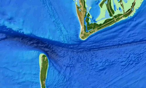
Gives a unique perspective of underwater topography at a glance. Created from the high-definition contour data within SonarChart, Navionics shading presents a detailed rendering of the seafloor and lake bottoms in varying shades of blue.
3D View
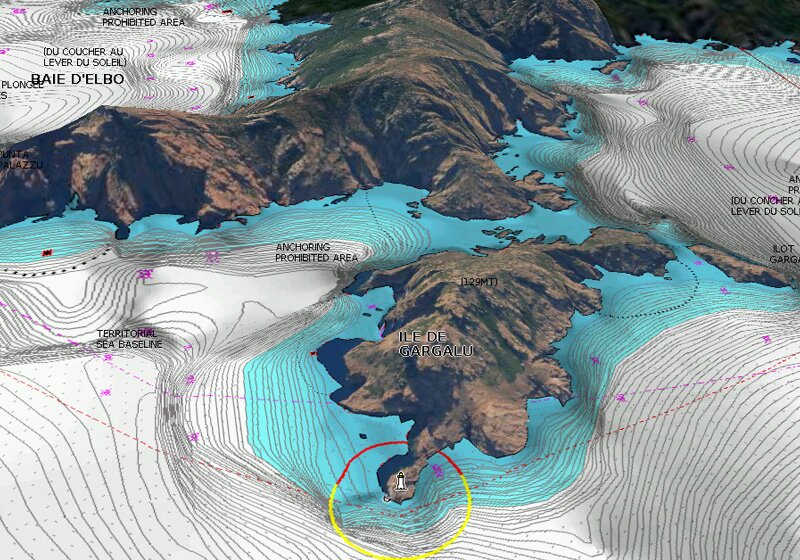
Dynamic 3D View allows you to customize your chart to highlight key features for a better awareness of your surroundings.
Panoramic Photos

Panoramic photos give a better sense of the surroundings so you can evaluate your options.
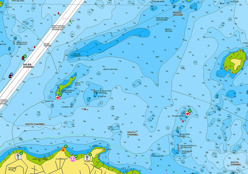
NAUTICAL CHART
Go boating with comprehensive charts derived from multiple official, government and private sources, displayed in a familiar look and feel.

SONARCHART™
Understand depths and bottom detail with our innovative 0.5 m bathymetric charts created using Navionics proprietary systems that process sonar data contributed by boaters with existing content.

COMMUNITY EDITS
Get useful local knowledge from fellow boaters in this crowdsourced content layer packed with points of interest, navigation aids and variety of edits made by users of our boating app.
ACTIVECAPTAIN COMMUNITY
Benefit from an additional source of information shared by the ActiveCaptain® Community in the Navionics Boating app. Find a large and diverse set of POIs, such as marinas, anchorages, hazards, businesses and more.
DAILY UPDATES
We constantly enhance our charts with new and amended content from official hydrographic sources, public and private surveys, and millions of contributions from boaters.
Navionics make up to 5,000 updates every day affecting all our chart layers.
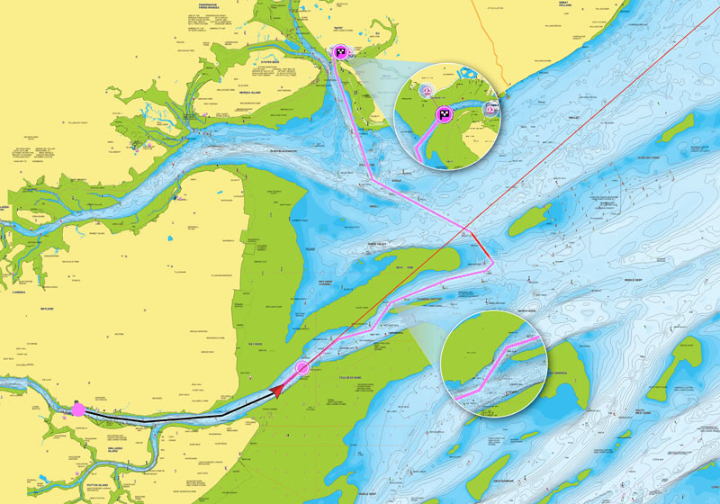
DOCK-TO-DOCK AUTOROUTING*
Head to the next destination with Dock-to-dock Autorouting*. It creates a suggested route, from a real start point to a real end point, based on chart data and navigation aids.
SONARCHART LIVE
Convert your sonar data into a Bathymetric map. Watch new 0.5 m personal HD bathymetric maps develop in real time as your boat moves along the water! It appears as an additional layer over your map, while it also gets stored on your device for future use.
SonarChart Live also makes it possible to create new maps of uncharted areas. If your favorite water body is missing from our maps, get on the water and benefit immediately from the results.

PLOTTER SYNC
Plotter Sync allows compatible chartplotter owners to transfer routes and markers, update chart layers and more — to and from the Navionics Boating app.
ADVANCED MAP OPTIONS
Change the way you view Navionics charts and focus on the details that matter most to you. Highlight shallow areas, adjust contour density or select a fishing range.
Click here for chart plotter compatibility
*Autorouting is for planning purposes only and does not replace safe navigation operations.